Technology

Game-changer
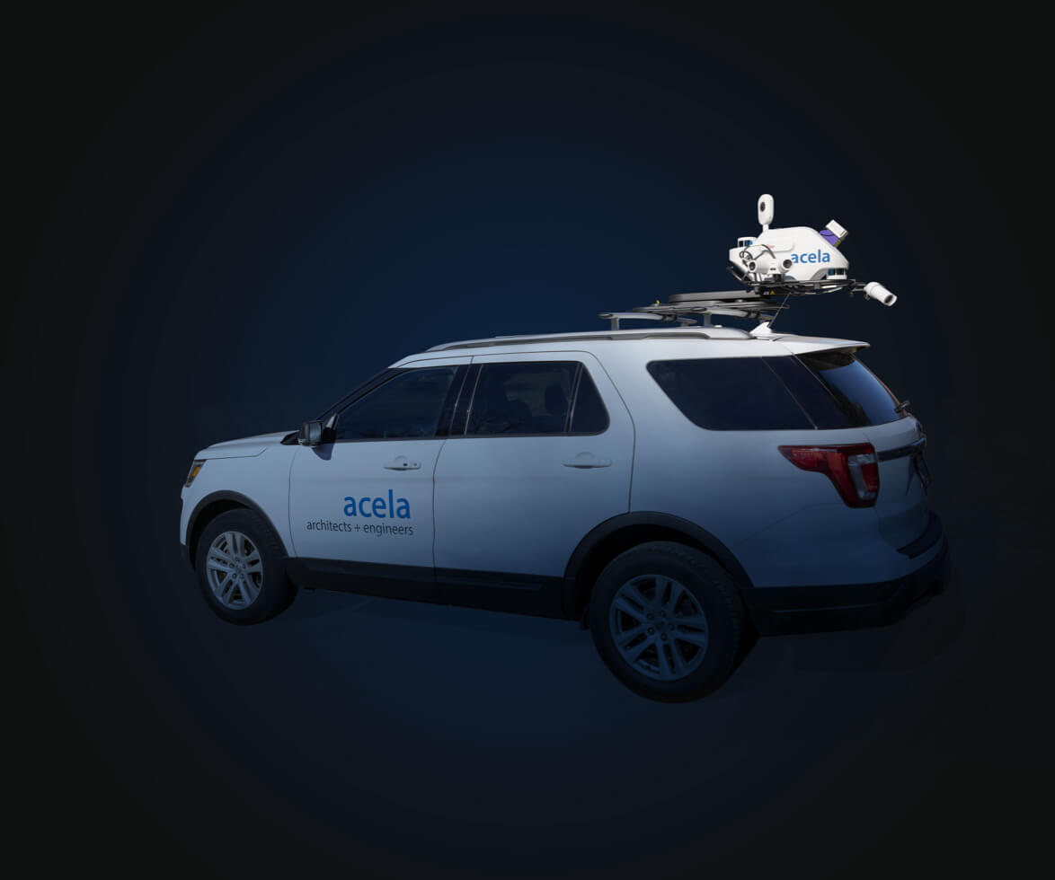
Acela Architects + Engineers, P.C. is among the first firms in the US to invest in the new Leica Pegasus TRK500 Neo mobile mapping system for surveying and geographical measurement.
Developed by Leica Geosystems of Switzerland and described as "the future of mobile mapping," it is the only survey-grade mobile mapping unit currently available that is capable of providing three-dimensional points of everything it sees—capturing 500,000 point cloud data sets per second—all while traveling at highway speeds.

Reducing survey costs
This is a game-changing tool that allows Acela to survey areas in an hour that would normally take days or even several weeks to survey. This greatly reduces survey costs while improving the safety of Acela’s surveyors since they no longer need to stand on the road surface or shoulder to survey it.
Endless applications
It’s particularly useful to create asset inventory for municipalities, governments, schools, colleges and private campuses. Leica’s new TRK500 system will automatically log items such as utility poles, sidewalks, tripping hazards, street conditions, street landscaping, signage and traffic control devices.
The core LIDAR technology—acronym for laser imaging/detection and ranging—has been around for a while but the new TRK500 system takes functionality, workflow and sheer speed to an entirely new level.


Terrestrial Scanning
Highly accurate 3D images and measurements of buildings and other structures are now being captured with unprecedented speed and cost-efficiency with a highly portable new surveying technology now in use by Acela Architects + Engineers.
Developed by Leica Geosystems of Switzerland, it ranks among the most advanced terrestrial scanning technologies available. Acela is one of the first firms in the US to invest in the RTC 360 and it quickly became a measuring mainstay of the firm’s civil engineering team’s technological toolbox.